
In March this year, Geographicus Rare Antique Maps, a specialist dealer in fine and rare antiquarian cartography and historic maps, donated their collection of over 2000 digital images to Wikimedia Commons. Here is just a small selection of a really great collection. Explore more, and help Wikimedia to categorise them, here. Each map shown below is linkable to the Wikimedia Commons page with more info about the map and higher resolution images. Huge thank you to Geographicus for sharing these amazing images!

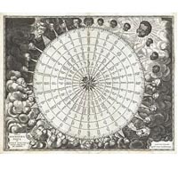
Tabula Anemographica seu Pyxis Nautica Ventorum Nomina Sex Linguis Repraesentans (1650) by Jan Jansson or Johannes Janssonius (1588–1664)

Nova Totius Terrarum Orbis Tabula (1684) by A. J. Bormeester

Perigrinatie ofte Veertich-Iarige Reyse der Kinderen Israels (1702) by N. Visscher and D. Stoopendaal
_-_Geographicus_-_Paris-turgot-1909.jpg)
Plan de Paris, the c. 1900 Taride edition of Louis Bretez and Michel-Etienne Turgot’s monumental 1739 map of Paris.
_-_Geographicus_-_Catalogne-ratelband-1747.jpg)
Principaute de Catalogne et Partie du Rous sillon Echelle de Lieux, a stunning map of Catalonia, Spain first drawn by Daniel de la Feuille in 1706

Eiland Ormus, of Jerun, engraved by Jacob Van der Schley under the supervision of J. Bellin for the c. 1750 edition of Provost’s L`Histoire Generale des Voyages

Sphere de Ptolomee, a beautiful example of Rigobert Bonne’s curious decorative chart of the Spheres (1775)

A General Map of the World, or Terraqueouis Globe with all the New Discoveries and Marginal Delineations, Containing the Most Interesting Particulars in the Solar, Starry and Mundane System; an absolutely stunning and monumental double hemisphere wall map of the world by Samuel Dunn dating to 1794
_-_Geographicus_-_NYC33Miles-colton-1879.jpg)
Map Of The Country Thirty Three Miles Around The City Of New York (1879), by Joseph Hutchins Colton

Shintei – Chikyu Bankoku Hozu (Square Map of all the Countries on the Globe); a very interesting 1853 (Kaei 6) Japanese world map by Suido Nakajima.
Related Links:
This article on Public Domain Review
Wikimedia Commons
MAPS FROM GEOGRAPHICUS was originally published in The Public Domain Review under a Creative Commons Attribution 3.0 license. If you wish to reuse it please see: http://publicdomainreview.org/legal/